
Mapa topográfico Bimini
Mapa interactivo
Haga clic en el mapa para ver la altitud.
Acerca de este mapa
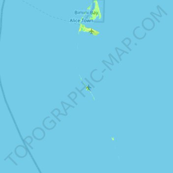
Nombre: Mapa topográfico Bimini, altitud, relieve.
Lugar: Bimini, The Bahamas (25.33296 -79.31465 25.77899 -79.17919)
Altitud media: 0 m
Altitud mínima: -1 m
Altitud máxima: 21 m
Otros mapas topográficos
Haga clic en un mapa para ver su topografía, su altitud y su relieve.
Grand Bahama
The Bahamas > East Grand Bahama
Grand Bahama, East Grand Bahama, The Bahamas
Altitud media: 1 m
Goat Cay
The Bahamas > Crooked Island and Long Cay
Goat Cay, Crooked Island and Long Cay, The Bahamas
Altitud media: 0 m
Sunshine Park
Sunshine Park, New Providence, The Bahamas
Altitud media: 7 m
Coconut Grove
The Bahamas > Coconut Grove > New Providence
Coconut Grove, New Providence, The Bahamas
Altitud media: 8 m
Long Cay
The Bahamas > Crooked Island and Long Cay
Long Cay, Crooked Island and Long Cay, The Bahamas
Altitud media: 0 m
North Palmetto Point
The Bahamas > Central Eleuthera
North Palmetto Point, Central Eleuthera, The Bahamas
Altitud media: 9 m
Cabbage Hill Settlement
The Bahamas > Crooked Island and Long Cay
Cabbage Hill Settlement, Crooked Island and Long Cay, The Bahamas
Altitud media: 7 m
Great Harbour Cay
Great Harbour Cay, Berry Islands, The Bahamas
Altitud media: 1 m
Windermere Island
The Bahamas > Central Eleuthera
Windermere Island, Central Eleuthera, The Bahamas
Altitud media: 3 m
Savannah Sound
The Bahamas > Central Eleuthera
Savannah Sound, Central Eleuthera, The Bahamas
Altitud media: 5 m
Imperial Park
Imperial Park, New Providence, The Bahamas
Altitud media: 6 m
Lucaya
The Bahamas > City of Freeport > Lucaya
Lucaya, City of Freeport, The Bahamas
Altitud media: 7 m
Emerald Coast
Emerald Coast, New Providence, The Bahamas
Altitud media: 7 m