
Mapa topográfico Hollandsche Rading
Mapa interactivo
Haga clic en el mapa para ver la altitud.
Acerca de este mapa
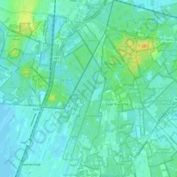
Nombre: Mapa topográfico Hollandsche Rading, altitud, relieve.
Lugar: Hollandsche Rading, De Bilt, Utrecht, Niederlande (52.16510 5.11529 52.20427 5.21630)
Altitud media: 6 m
Altitud mínima: -2 m
Altitud máxima: 27 m
Otros mapas topográficos
Haga clic en un mapa para ver su topografía, su altitud y su relieve.