
Gracias por apoyar a este sitio ❤️
Haz una donación
Haz una donación
Mapa topográfico Malton
Haga clic en el mapa para ver la altitud.
Gracias por apoyar a este sitio ❤️
Haz una donación
Haz una donación
Malton
As with the rest of the British Isles and Yorkshire, Malton possesses a maritime climate with cool summers and mild winters. The nearest Met Office weather station for which records are available is High Mowthorpe, about 6 miles (10 km) east of the town centre. Due to its lower elevation, the town centre is likely to be marginally warmer than High Mowthorpe throughout the year.
Gracias por apoyar a este sitio ❤️
Haz una donación
Haz una donación
Acerca de este mapa
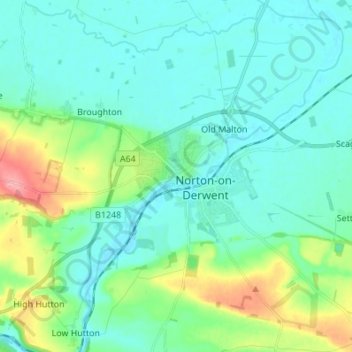
Nombre: Mapa topográfico Malton, altitud, relieve.
Altitud media: 38 m
Altitud mínima: 15 m
Altitud máxima: 125 m
Gracias por apoyar a este sitio ❤️
Haz una donación
Haz una donación