
Mapa topográfico Bagworth Heath Woods
Mapa interactivo
Haga clic en el mapa para ver la altitud.
Acerca de este mapa
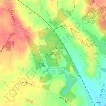
Nombre: Mapa topográfico Bagworth Heath Woods, altitud, relieve.
Altitud media: 138 m
Altitud mínima: 102 m
Altitud máxima: 170 m
Otros mapas topográficos
Haga clic en un mapa para ver su topografía, su altitud y su relieve.
Thornton Reservoir
United Kingdom > England > Leicestershire > Hinckley and Bosworth > Thornton
Thornton Reservoir, Bagworth & Thornton, Thornton, Hinckley and Bosworth, Leicestershire, England, United Kingdom
Altitud media: 139 m