
Gracias por apoyar a este sitio ❤️
Haz una donación
Haz una donación
Mapa topográfico Unterntief
Haga clic en el mapa para ver la altitud.
Gracias por apoyar a este sitio ❤️
Haz una donación
Haz una donación
Acerca de este mapa
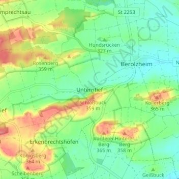
Nombre: Mapa topográfico Unterntief, altitud, relieve.
Altitud media: 327 m
Altitud mínima: 300 m
Altitud máxima: 372 m
Gracias por apoyar a este sitio ❤️
Haz una donación
Haz una donación
Otros mapas topográficos
Haga clic en un mapa para ver su topografía, su altitud y su relieve.
91438
Deutschland > Bayern > Landkreis Neustadt an der Aisch-Bad Windsheim > Bad Windsheim > Erkenbrechtshofen
Altitud media: 333 m