
Haz una donación
Mapa topográfico Out Skerries
Haga clic en el mapa para ver la altitud.
Haz una donación
Out Skerries
Being so close to Norway, the islands were of strategic importance in World War II and were a regular landfall for Norwegian boats carrying escapees from the Nazi occupation. The local coastguard was responsible for the refugees, and at one point during the war were issued with a tommy gun, although initially no-one knew how to use it. German planes frequently flew over at low altitudes, strafing the Grunay lighthouse shore station in 1941 and dropping a bomb in 1942. The latter attack killed Mary Anderson, the only local casualty of the war, and Grunay was evacuated soon afterwards. A month later, a Canadian bomber crashed on Grunay, and in 1990 a plaque was raised to commemorate that event. Dey (1991) states that the bomber was a "British" Blenheim bomber with a crew of two Canadians and one Englishman. The plaque ceremony was attended by the family of F/Sgt Jay Oliver, one of the two Canadian casualties, and Peter Johnson, a local man who had witnessed the crash aged eight years. During the war, an official letter was sent in secret to the local sub-postmistress with instructions that it be opened in the event of a German invasion. After the war, it was returned, unopened.
Haz una donación
Acerca de este mapa
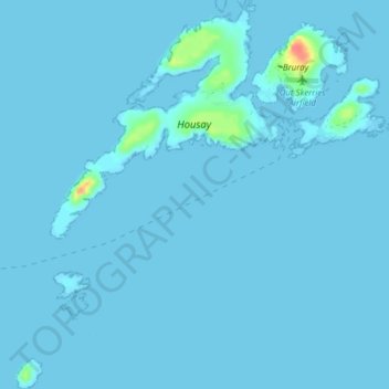
Nombre: Mapa topográfico Out Skerries, altitud, relieve.
Lugar: Out Skerries, Shetland, Scotland, United Kingdom (60.39475 -0.80577 60.43433 -0.72899)
Altitud media: 1 m
Altitud mínima: -2 m
Altitud máxima: 46 m
Haz una donación
Otros mapas topográficos
Haga clic en un mapa para ver su topografía, su altitud y su relieve.
Ronas Hill
United Kingdom > Scotland > Shetland
Ronas Hill (or Rönies Hill) is a hill in Shetland, Scotland. It is classed as a Marilyn, and is the highest point in the Shetland Islands at an elevation of 450 m (1,480 ft). A Neolithic chambered cairn is located near the summit.
Altitud media: 298 m
Haz una donación
Haz una donación
Haz una donación
Haz una donación
Haz una donación
Haz una donación
Haz una donación