
Mapa topográfico Baiyin
Mapa interactivo
Haga clic en el mapa para ver la altitud.
Baiyin
Baiyin is part loess plateau, part desert. Elevation ranges from 1,275 to 3,321 meters (4,183 to 10,896 feet) above sea-level. The climate is very arid with only 110–352 mm (4.3–13.9 in) of annual precipitation. Annual evaporation is 2,101 mm (82.7 in) resulting in a net loss of approximately 1,800 mm (71 in). The Yellow River flows from south to north for 214 km (133 mi) through Baiyin.
Acerca de este mapa
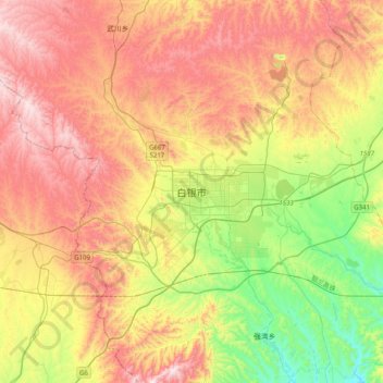
Nombre: Mapa topográfico Baiyin, altitud, relieve.
Lugar: Baiyin, Baiyin District, Baiyin City, Gansu, China (36.38516 103.97554 36.70516 104.29554)
Altitud media: 1.836 m
Altitud mínima: 1.460 m
Altitud máxima: 2.239 m