
Mapa topográfico Sudeley Castle
Mapa interactivo
Haga clic en el mapa para ver la altitud.
Acerca de este mapa
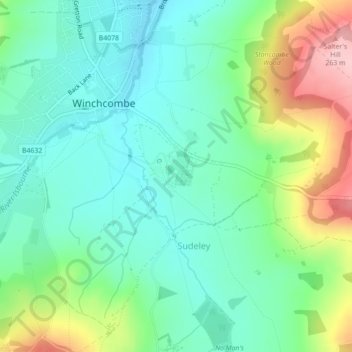
Nombre: Mapa topográfico Sudeley Castle, altitud, relieve.
Altitud media: 135 m
Altitud mínima: 77 m
Altitud máxima: 269 m
His elevation almost certainly came from his assistance in the suppression of the Wyatt rebellion.