Geolocalizar

Mapa topográfico Lambley Lane Recreation Ground (North)

Mapa interactivo

Haga clic en el mapa para ver la altitud.

Acerca de este mapa

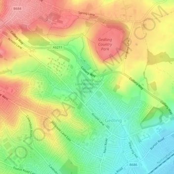
Nombre: Mapa topográfico Lambley Lane Recreation Ground (North), altitud, relieve.

Lugar: Lambley Lane Recreation Ground (North), Gedling, Carlton, Gedling, Nottinghamshire, England, United Kingdom (52.98053 -1.08844 52.98573 -1.08285)

Altitud media: 73 m

Altitud mínima: 21 m

Altitud máxima: 124 m

Otros mapas topográficos

Haga clic en un mapa para ver su topografía, su altitud y su relieve.

Colwick Country Park

United Kingdom > England > Nottinghamshire > Gedling > Carlton > Colwick

Colwick Country Park, Colwick, Carlton, Gedling, Nottinghamshire, England, NG4 2EW, United Kingdom

Altitud media: 32 m

Carlton

United Kingdom > England > Nottinghamshire > Gedling > Carlton

Carlton, Gedling, Nottinghamshire, East Midlands, England, NG4 1SR, United Kingdom

Altitud media: 51 m