
Mapa topográfico Tashkorgan Town
Mapa interactivo
Haga clic en el mapa para ver la altitud.
Tashkorgan Town
British archaeologist Aurel Stein argued that, judging from the topography and remains found around Tashkurgan, the fort and associated settlements had clearly been central to the broader Sarikol area, controlling routes from the Oxus to the oases of southern Turkestan.
Acerca de este mapa
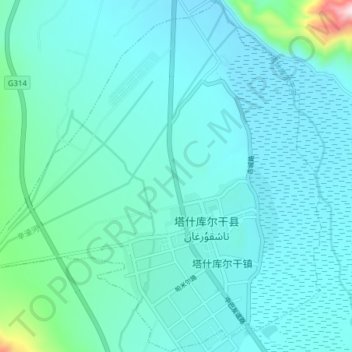
Nombre: Mapa topográfico Tashkorgan Town, altitud, relieve.
Altitud media: 3.109 m
Altitud mínima: 3.046 m
Altitud máxima: 3.712 m