
Mapa topográfico La Center
Mapa interactivo
Haga clic en el mapa para ver la altitud.
Acerca de este mapa
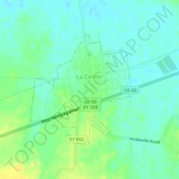
Nombre: Mapa topográfico La Center, altitud, relieve.
Lugar: La Center, Ballard County, Kentucky, United States (37.06646 -88.98488 37.08302 -88.96574)
Altitud media: 111 m
Altitud mínima: 102 m
Altitud máxima: 126 m
Otros mapas topográficos
Haga clic en un mapa para ver su topografía, su altitud y su relieve.
Slater
United States > Kentucky > Ballard County
Slater, Ballard County, Kentucky, United States
Altitud media: 135 m
Barlow
United States > Kentucky > Ballard County
Barlow, Ballard County, Kentucky, United States
Altitud media: 110 m
Kevil
United States > Kentucky > Ballard County
Kevil, Ballard County, Kentucky, United States
Altitud media: 132 m
Wickliffe
United States > Kentucky > Ballard County
Wickliffe, Ballard County, Kentucky, United States
Altitud media: 110 m