
Mapa topográfico Otford
Mapa interactivo
Haga clic en el mapa para ver la altitud.
Acerca de este mapa
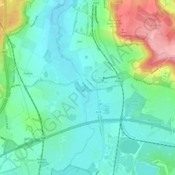
Nombre: Mapa topográfico Otford, altitud, relieve.
Lugar: Otford, Sevenoaks, Kent, England, United Kingdom (51.29608 0.16204 51.32575 0.22032)
Altitud media: 94 m
Altitud mínima: 51 m
Altitud máxima: 210 m
Otros mapas topográficos
Haga clic en un mapa para ver su topografía, su altitud y su relieve.
Penshurst
United Kingdom > England > Kent > Sevenoaks
Penshurst, Sevenoaks, Kent, England, United Kingdom
Altitud media: 66 m