
Gracias por apoyar a este sitio ❤️
Haz una donación
Haz una donación
Mapa topográfico Ashley
Haga clic en el mapa para ver la altitud.
Gracias por apoyar a este sitio ❤️
Haz una donación
Haz una donación
Acerca de este mapa
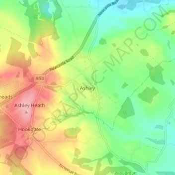
Nombre: Mapa topográfico Ashley, altitud, relieve.
Altitud media: 166 m
Altitud mínima: 112 m
Altitud máxima: 240 m
Gracias por apoyar a este sitio ❤️
Haz una donación
Haz una donación
Otros mapas topográficos
Haga clic en un mapa para ver su topografía, su altitud y su relieve.
College Gardens
United Kingdom > England > Staffordshire > Newcastle-under-Lyme > Madeley
Altitud media: 123 m
Birks Wood
United Kingdom > England > Staffordshire > Newcastle-under-Lyme > Shraleybrook
Altitud media: 109 m
Gracias por apoyar a este sitio ❤️
Haz una donación
Haz una donación