
Mapa topográfico Long Eaton
Mapa interactivo
Haga clic en el mapa para ver la altitud.
Acerca de este mapa
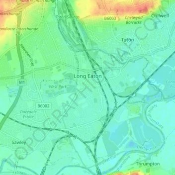
Nombre: Mapa topográfico Long Eaton, altitud, relieve.
Lugar: Long Eaton, Erewash, Derbyshire, England, United Kingdom (52.87329 -1.30594 52.91789 -1.23840)
Altitud media: 35 m
Altitud mínima: 22 m
Altitud máxima: 75 m
Otros mapas topográficos
Haga clic en un mapa para ver su topografía, su altitud y su relieve.
Ilkeston
United Kingdom > England > Derbyshire > Erewash > Ilkeston
Ilkeston, Erewash, Derbyshire, East Midlands, England, DE7 5JA, United Kingdom
Altitud media: 81 m