
Mapa topográfico Sandon
Mapa interactivo
Haga clic en el mapa para ver la altitud.
Acerca de este mapa
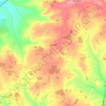
Nombre: Mapa topográfico Sandon, altitud, relieve.
Altitud media: 130 m
Altitud mínima: 69 m
Altitud máxima: 172 m
Otros mapas topográficos
Haga clic en un mapa para ver su topografía, su altitud y su relieve.
Newnham
United Kingdom > England > Hertfordshire > North Hertfordshire
Newnham, North Hertfordshire, Hertfordshire, England, United Kingdom
Altitud media: 69 m