
Gracias por apoyar a este sitio ❤️
Haz una donación
Haz una donación
Mapa topográfico Westwell
Haga clic en el mapa para ver la altitud.
Gracias por apoyar a este sitio ❤️
Haz una donación
Haz una donación
Acerca de este mapa
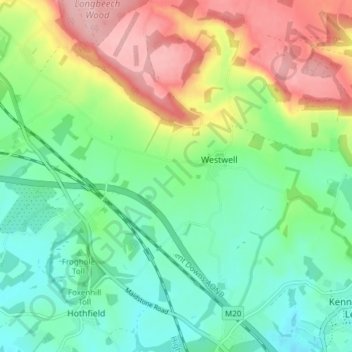
Nombre: Mapa topográfico Westwell, altitud, relieve.
Lugar: Westwell, Ashford, Kent, England, United Kingdom (51.16611 0.80953 51.21375 0.86764)
Altitud media: 98 m
Altitud mínima: 43 m
Altitud máxima: 195 m
Gracias por apoyar a este sitio ❤️
Haz una donación
Haz una donación