
Mapa topográfico Nankai
Mapa interactivo
Haga clic en el mapa para ver la altitud.
Nankai
Nankai District is located in the south-west corner of the urban Tianjin, bordered by Hongqiao District to the north, Hebei and Heping Districts to the north-east, Hexi District to the east and Xiqing District to the south-west. It occupies an area of 40.64 square kilometres (15.69 sq mi). The natural topography is characterised by higher elevation in the north of the district and a lower elevation in the south, with the average altitude being 3 metres.
Acerca de este mapa
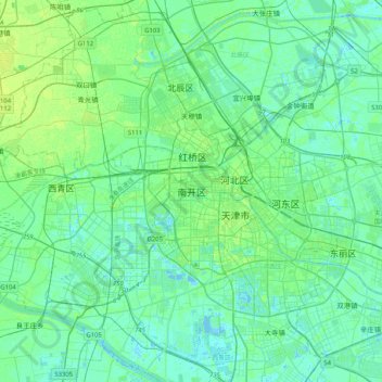
Nombre: Mapa topográfico Nankai, altitud, relieve.
Lugar: Nankai, Nankai District, Tianjin, 300084, China (38.97701 116.98395 39.29701 117.30395)
Altitud media: 5 m
Altitud mínima: -5 m
Altitud máxima: 19 m
Otros mapas topográficos
Haga clic en un mapa para ver su topografía, su altitud y su relieve.