
Gracias por apoyar a este sitio ❤️
Haz una donación
Haz una donación
Mapa topográfico Killarney
Haga clic en el mapa para ver la altitud.
Gracias por apoyar a este sitio ❤️
Haz una donación
Haz una donación
Acerca de este mapa
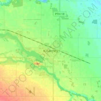
Nombre: Mapa topográfico Killarney, altitud, relieve.
Altitud media: 495 m
Altitud mínima: 475 m
Altitud máxima: 526 m
Gracias por apoyar a este sitio ❤️
Haz una donación
Haz una donación
Otros mapas topográficos
Haga clic en un mapa para ver su topografía, su altitud y su relieve.
Pelican Lake
Canada > Manitoba > Municipality of Killarney-Turtle Mountain
The lake is normally maintained at elevations between 411.5 and 412 metres (1,350 and 1,352 ft) above sea level during summer months. During the spring period, the lake may be raised temporarily to an elevation of 412.2 metres (1,352 ft). When the lake is low, water may be diverted from the Pembina River into…
Altitud media: 459 m