
Mapa topográfico Burr Well
Haga clic en el mapa para ver la altitud.
Acerca de este mapa
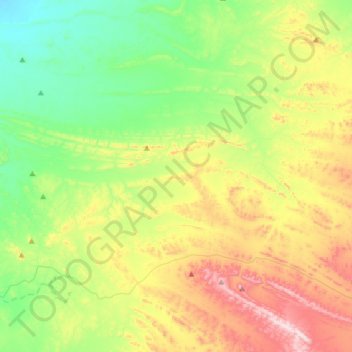
Nombre: Mapa topográfico Burr Well, altitud, relieve.
Altitud media: 394 m
Altitud mínima: 184 m
Altitud máxima: 776 m
Otros mapas topográficos
Haga clic en un mapa para ver su topografía, su altitud y su relieve.
Dullingari
Australia > South Australia > Pastoral Unincorporated Area > Innamincka
Altitud media: 89 m
Bookabourdie Waterhole
Australia > South Australia > Pastoral Unincorporated Area > Innamincka
Altitud media: 44 m
Nullabor Plain
Australia > South Australia > Pastoral Unincorporated Area
One theory is that the whole area was uplifted by crustal movements in the Miocene, and since then, erosion by wind and rain has reduced its thickness. The plain has most likely never had any major defining topographic features, resulting in the extremely flat terrain across the plain today.
Altitud media: 117 m
Mungerannie
Australia > South Australia > Pastoral Unincorporated Area > Mungerannie
Altitud media: 59 m
Leigh Creek
Australia > South Australia > Pastoral Unincorporated Area > Leigh Creek
Altitud media: 267 m
Fowlers Bay
Australia > South Australia > Pastoral Unincorporated Area > Fowlers Bay
Altitud media: 3 m