
Gracias por apoyar a este sitio ❤️
Haz una donación
Haz una donación
Mapa topográfico Billinge Hill
Haga clic en el mapa para ver la altitud.
Gracias por apoyar a este sitio ❤️
Haz una donación
Haz una donación
Billinge Hill
Billinge Hill is in the Metropolitan Borough of St Helens in North West England. With a maximum elevation of 179 m (587 ft), it is the highest point of Merseyside. It lies in Billinge, within the historic county boundaries of Lancashire, and it is one of the 176 hills graded as a Marilyn in England.
Gracias por apoyar a este sitio ❤️
Haz una donación
Haz una donación
Acerca de este mapa
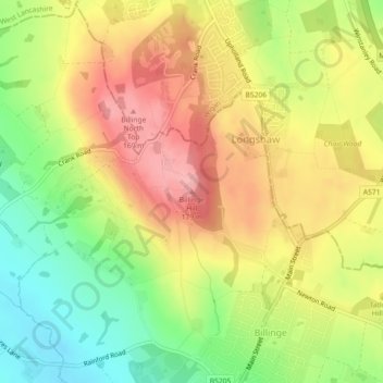
Nombre: Mapa topográfico Billinge Hill, altitud, relieve.
Altitud media: 115 m
Altitud mínima: 49 m
Altitud máxima: 175 m
Gracias por apoyar a este sitio ❤️
Haz una donación
Haz una donación
Otros mapas topográficos
Haga clic en un mapa para ver su topografía, su altitud y su relieve.