
Gracias por apoyar a este sitio ❤️
Haz una donación
Haz una donación
Mapa topográfico Llangoedmor
Haga clic en el mapa para ver la altitud.
Gracias por apoyar a este sitio ❤️
Haz una donación
Haz una donación
Llangoedmor
Llangoedmor was the site of a 12th-century battle. Samuel Lewis's A Topographical Dictionary of Wales (1833) states.
Gracias por apoyar a este sitio ❤️
Haz una donación
Haz una donación
Acerca de este mapa
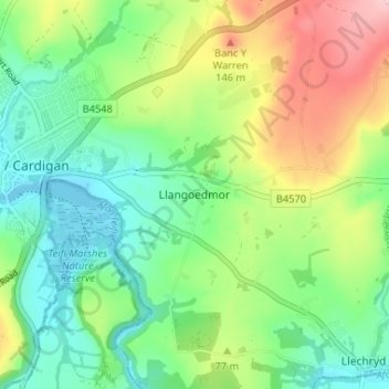
Nombre: Mapa topográfico Llangoedmor, altitud, relieve.
Lugar: Llangoedmor, Ceredigion, Wales, SA43 2LH, United Kingdom (52.06100 -4.64922 52.10100 -4.60922)
Altitud media: 60 m
Altitud mínima: -2 m
Altitud máxima: 169 m
Gracias por apoyar a este sitio ❤️
Haz una donación
Haz una donación