
Gracias por apoyar a este sitio ❤️
Haz una donación
Haz una donación
Mapa topográfico Glasshouse
Haga clic en el mapa para ver la altitud.
Gracias por apoyar a este sitio ❤️
Haz una donación
Haz una donación
Acerca de este mapa
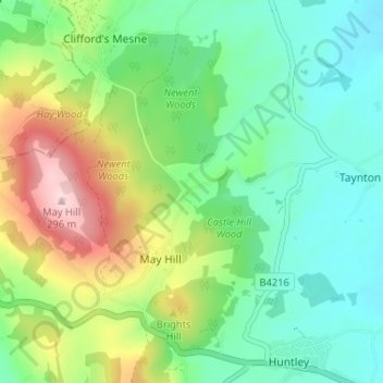
Nombre: Mapa topográfico Glasshouse, altitud, relieve.
Altitud media: 110 m
Altitud mínima: 20 m
Altitud máxima: 303 m
Gracias por apoyar a este sitio ❤️
Haz una donación
Haz una donación
Otros mapas topográficos
Haga clic en un mapa para ver su topografía, su altitud y su relieve.
Newent Woods
United Kingdom > England > Gloucestershire > Forest of Dean > May Hill
Altitud media: 157 m