
Haz una donación
Mapa topográfico Staffordtown
Haga clic en el mapa para ver la altitud.
Haz una donación
Staffordtown
Staffordtown is situated in the scenic Appalachian region, characterized by its rugged terrain and lush forests. The area is marked by steep hills and rolling valleys that define the landscape, with elevations ranging from around 1,500 to 3,000 feet above sea level. The surrounding mountains, part of the larger Blue Ridge range, create a dramatic backdrop, while numerous small streams and rivers, including the nearby Ocoee River, flow through the region, contributing to its rich biodiversity. The topography not only offers picturesque views but also provides opportunities for outdoor activities such as hiking, fishing, and whitewater rafting, making it a notable spot for nature enthusiasts.
Haz una donación
Acerca de este mapa
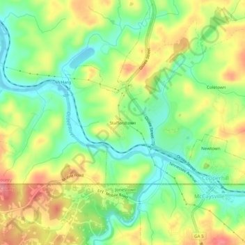
Nombre: Mapa topográfico Staffordtown, altitud, relieve.
Altitud media: 478 m
Altitud mínima: 435 m
Altitud máxima: 532 m
Haz una donación