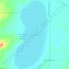
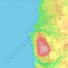
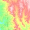
Mapa topográfico Leering Bay
Haga clic en el mapa para ver la altitud.
Acerca de este mapa

Nombre: Mapa topográfico Leering Bay, altitud, relieve.
Lugar: Leering Bay, Shire Of Broome, Western Australia, Australia (-16.40759 123.17396 -16.40749 123.17406)
Altitud media: 14 m
Altitud mínima: -1 m
Altitud máxima: 56 m
Otros mapas topográficos
Haga clic en un mapa para ver su topografía, su altitud y su relieve.






Stirling Range National Park
The park is particularly rich in banksias, eucalypts, orchids and verticordias. Ten species of mountain bells (Darwinia spp.) have been identified in the park and only one of these is found outside Stirling Range. Five major vegetation communities are known in the park with thicket and mallee-heath at higher…
Altitud media: 235 m