
Haz una donación
Mapa topográfico Kula
Haga clic en el mapa para ver la altitud.
Haz una donación
Kula
Kula is a district and census-designated place (CDP) of Maui, Hawaii, that stretches across the "up-country", the western-facing slopes of Haleakalā, from Makawao to Kanaio. Most of the residential areas lie between about 500 to 1,100 m (1,600 to 3,600 ft) in elevation. The district has traditionally been where full-time residents prefer to live, as distinct from the generally hotter and busier, more tourism-oriented towns near sea level, such as Kihei and Lahaina. The population of the Kula CDP at the 2020 Census was 6,942, while the larger Kula Census County Division, which includes the communities of Keokea, Wailea, and Makena, had a population of 12,864.
Haz una donación
Acerca de este mapa
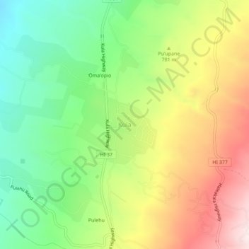
Nombre: Mapa topográfico Kula, altitud, relieve.
Lugar: Kula, Maui County, Hawaii, 96790, United States (20.77203 -156.34371 20.81203 -156.30371)
Altitud media: 740 m
Altitud mínima: 473 m
Altitud máxima: 1.089 m
Haz una donación