
Mapa topográfico Chadron
Mapa interactivo
Haga clic en el mapa para ver la altitud.
Acerca de este mapa
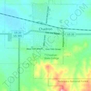
Nombre: Mapa topográfico Chadron, altitud, relieve.
Altitud media: 1.052 m
Altitud mínima: 1.013 m
Altitud máxima: 1.181 m
Chadron is located at 3,400 feet in elevation. It is surrounded by prairie grassland, broken by a ridge of lightly forested hills to the south.