
Mapa topográfico Rivière Beaudette
Mapa interactivo
Haga clic en el mapa para ver la altitud.
Acerca de este mapa
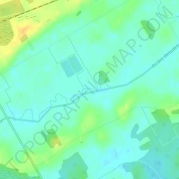
Nombre: Mapa topográfico Rivière Beaudette, altitud, relieve.
Altitud media: 69 m
Altitud mínima: 60 m
Altitud máxima: 87 m
Otros mapas topográficos
Haga clic en un mapa para ver su topografía, su altitud y su relieve.
Glen Walter
Canada > Ontario > South Glengarry > Glen Walter
Glen Walter, South Glengarry, Stormont, Dundas and Glengarry Counties, Eastern Ontario, Ontario, K6H 5R5, Canada
Altitud media: 50 m
Raisin River
Canada > Ontario > South Glengarry
Raisin River, South Glengarry, Stormont, Dundas and Glengarry Counties, Eastern Ontario, Ontario, K0C 2A0, Canada
Altitud media: 73 m
Cooper Marsh Conservation Area
Canada > Ontario > South Glengarry
Cooper Marsh Conservation Area, Muskrat Motor, South Glengarry, Stormont, Dundas and Glengarry Counties, Eastern Ontario, Ontario, K0C 1N0, Canada
Altitud media: 48 m