
Mapa topográfico Restormel Castle
Mapa interactivo
Haga clic en el mapa para ver la altitud.
Acerca de este mapa
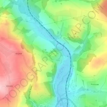
Nombre: Mapa topográfico Restormel Castle, altitud, relieve.
Altitud media: 79 m
Altitud mínima: 2 m
Altitud máxima: 185 m
Otros mapas topográficos
Haga clic en un mapa para ver su topografía, su altitud y su relieve.
Lostwithiel
United Kingdom > England > Lostwithiel
Lostwithiel, Cornwall, South West England, England, PL22, United Kingdom
Altitud media: 94 m