
Mapa topográfico West Belt
Mapa interactivo
Haga clic en el mapa para ver la altitud.
Acerca de este mapa
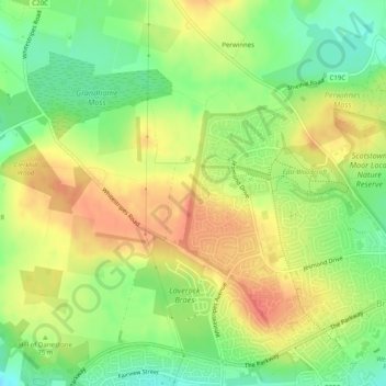
Nombre: Mapa topográfico West Belt, altitud, relieve.
Altitud media: 72 m
Altitud mínima: 42 m
Altitud máxima: 99 m
Otros mapas topográficos
Haga clic en un mapa para ver su topografía, su altitud y su relieve.
Peterculter
United Kingdom > Scotland > Aberdeen City > Peterculter
Peterculter, Aberdeen City, Scotland, AB14 0SL, United Kingdom
Altitud media: 64 m