Geolocalizar

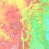
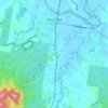
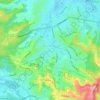
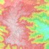
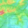
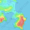
Mapa topográfico Burramoko Ridge

Haga clic en el mapa para ver la altitud.

Acerca de este mapa

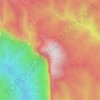
Nombre: Mapa topográfico Burramoko Ridge, altitud, relieve.

Lugar: Burramoko Ridge, Blue Mountains City Council, New South Wales, Australia (-33.60867 150.30026 -33.58513 150.31408)

Altitud media: 920 m

Altitud mínima: 547 m

Altitud máxima: 1.043 m

Otros mapas topográficos

Haga clic en un mapa para ver su topografía, su altitud y su relieve.
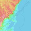
Sydney

Australia > New South Wales

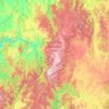
Sydney's topography is characterized by a diverse landscape that seamlessly blends coastal features with inland plateaus. The city is divided into two primary regions: the relatively flat Cumberland Plain to the south and west of Sydney Harbour, and the elevated Hornsby Plateau to the north. The Cumberland…

Altitud media: 51 m
Sydney

Australia > New South Wales > Sydney

Altitud media: 23 m

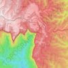
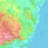
Mount Banks

Australia > New South Wales

Mount Banks, otherwise known as Mount King George, is a mountain within the Explorers Range of the Blue Mountains Range that is a spur off the Great Dividing Range, is located within the Blue Mountains National Park, approximately 100 kilometres (62 mi) west of Sydney in New South Wales, Australia. Mount Banks…

Altitud media: 745 m
Illawarra

Australia > New South Wales

Altitud media: 234 m

Tamworth

Australia > New South Wales

Altitud media: 489 m

Woombah

Australia > New South Wales

Altitud media: 14 m

Wentworth Falls

Australia > New South Wales > Sydney

Wentworth Falls (postcode: 2782) is a town in the Blue Mountains region of New South Wales, situated approximately 100 kilometres (62 mi) west of the Sydney central business district, and about 8 kilometres (5.0 mi) east of Katoomba, Australia on the Great Western Highway, with a Wentworth Falls railway…

Altitud media: 708 m
Armidale

Australia > New South Wales

Altitud media: 1.036 m

Albury

Australia > New South Wales

Altitud media: 246 m

Berry

Australia > New South Wales > Berry

Altitud media: 68 m

Manning River

Australia > New South Wales

Altitud media: 338 m

Pokolbin

Australia > New South Wales > Cessnock

Altitud media: 135 m

Umina Beach

Australia > New South Wales

Altitud media: 38 m

Grafton

Australia > New South Wales

Altitud media: 36 m

Wauchope

Australia > New South Wales

Altitud media: 32 m

Sydney

Australia > New South Wales

Phillip had been given no instructions for urban development, but in July 1788 submitted a plan for the new town at Sydney Cove. It included a wide central avenue, a permanent Government House, law courts, hospital and other public buildings, but no provision for warehouses, shops, or other commercial…

Altitud media: 32 m
Tuncurry

Australia > New South Wales

Altitud media: 2 m

Jindabyne

Australia > New South Wales

Altitud media: 1.077 m

Tambaroora

Australia > New South Wales

Altitud media: 761 m

Eucumbene Cove

Australia > New South Wales

Altitud media: 1.211 m

Mount Borah

Australia > New South Wales

Altitud media: 657 m

Griffith

Australia > New South Wales

Altitud media: 131 m

Horsley Park

Australia > New South Wales

Altitud media: 79 m

Barrington Tops

Australia > New South Wales

Altitud media: 1.107 m

Woy Woy

Australia > New South Wales

Altitud media: 35 m

Broken Hill

Australia > New South Wales

Altitud media: 142 m

Jindabyne

Australia > New South Wales > Jindabyne

Altitud media: 983 m

Asquith

Australia > New South Wales

Altitud media: 168 m

Harrington

Australia > New South Wales

Altitud media: 3 m

Turill

Australia > New South Wales

Altitud media: 459 m

Jindera

Australia > New South Wales

Altitud media: 272 m

Mororo

Australia > New South Wales

Altitud media: 35 m

Darlinghurst

Australia > New South Wales > Sydney

Altitud media: 38 m

Penrith

Australia > New South Wales > Sydney > Penrith

Penrith is a city in New South Wales, Australia, located in Greater Western Sydney, 55 kilometres (31 mi) west of the Sydney central business district on the banks of the Nepean River, on the outskirts of the Cumberland Plain. Its elevation is 32 metres (105 ft).

Altitud media: 34 m

Pittwater

Australia > New South Wales

Altitud media: 45 m

Taree

Australia > New South Wales

Altitud media: 17 m

Orange

Australia > New South Wales

Orange is a city in the Central Tablelands region of New South Wales, Australia. It is 254 km (158 mi) west of the state capital, Sydney [206 km (128 mi) on a great circle], at an altitude of 862 metres (2,828 ft). Orange had an estimated urban population of 40,493 as of June 2018 making the city a significant…

Altitud media: 852 m

Spring Farm

Australia > New South Wales

Altitud media: 88 m

Govetts Leap

Australia > New South Wales

Altitud media: 902 m

Glenbrook

Australia > New South Wales

Altitud media: 168 m

Moruya

Australia > New South Wales

Altitud media: 37 m

Bowral

Australia > New South Wales

Altitud media: 690 m

Alstonville

Australia > New South Wales

Altitud media: 131 m

Terrigal

Australia > New South Wales

Altitud media: 13 m

Somersby

Australia > New South Wales > Gosford

Altitud media: 151 m

Lisarow

Australia > New South Wales > Gosford

Altitud media: 66 m

Googong

Australia > New South Wales > Googong

Altitud media: 712 m

Mount Kościuszko

Australia > New South Wales

Mount Kosciuszko is the highest summit in mainland Australia. Until 1977 it was possible to drive from Charlotte Pass to within a few metres of the summit, but in 1977 the road was closed to public motor vehicle access due to environmental concerns. The road is open from Charlotte Pass for walkers and cyclists…

Altitud media: 2.035 m
Blacktown

Australia > New South Wales > Sydney

Altitud media: 57 m

Box Hill

Australia > New South Wales > Sydney

Altitud media: 45 m

Narrawallee

Australia > New South Wales

Altitud media: 18 m

Figtree

Australia > New South Wales > Wollongong

Altitud media: 57 m

Rockley

Australia > New South Wales

Altitud media: 915 m

Eagle Vale

Australia > New South Wales > Sydney

Altitud media: 81 m

Eurunderee

Australia > New South Wales

Altitud media: 508 m

Picton

Australia > New South Wales

Altitud media: 227 m

Yass

Australia > New South Wales

Yass is located 280 km south-west of Sydney, on the Hume Highway. The Yass River, which is a tributary of the Murrumbidgee River, flows through the town. Yass is 59 km from Canberra; lying at an elevation of 505 m AMSL.

Altitud media: 533 m
Mullumbimby

Australia > New South Wales

Altitud media: 29 m

Moss Vale

Australia > New South Wales

Altitud media: 673 m

Manly

Australia > New South Wales

Altitud media: 17 m

Bilpin

Australia > New South Wales

Altitud media: 527 m

Tyalgum

Australia > New South Wales

Altitud media: 161 m

Bangalow

Australia > New South Wales

Altitud media: 83 m

Crookwell

Australia > New South Wales

Crookwell is a small town located in the Southern Tablelands of New South Wales, Australia, in the Upper Lachlan Shire. At the 2016 census, Crookwell had a population of 2,641. The town is at a relatively high altitude of 887 metres and there are several snowfalls during the winter months. The nearest major…

Altitud media: 904 m

Terranora

Australia > New South Wales

Altitud media: 34 m

Gulmarrad

Australia > New South Wales

Altitud media: 10 m

Elands

Australia > New South Wales

Altitud media: 443 m

Dunoon

Australia > New South Wales

Altitud media: 142 m

Gaanha-bula–Mount Canobolas

Australia > New South Wales

With an elevation of 1,390 metres (4,560 ft) above sea level, Mount Canobolas, an extinct volcano, is the highest mountain in the region. Situated 13 kilometres (8.1 mi) southwest of the city of Orange, it is about 250 kilometres (155 mi) west of Sydney.

Altitud media: 1.186 m

Woodenbong

Australia > New South Wales

Altitud media: 474 m

Shoal Bay

Australia > New South Wales

Altitud media: 16 m