
Gracias por apoyar a este sitio ❤️
Haz una donación
Haz una donación
Mapa topográfico Carr
Haga clic en el mapa para ver la altitud.
Gracias por apoyar a este sitio ❤️
Haz una donación
Haz una donación
Acerca de este mapa
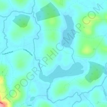
Nombre: Mapa topográfico Carr, altitud, relieve.
Lugar: Carr, County Fermanagh, Northern Ireland, United Kingdom (54.36739 -7.80179 54.37946 -7.78251)
Altitud media: 60 m
Altitud mínima: 44 m
Altitud máxima: 150 m
Gracias por apoyar a este sitio ❤️
Haz una donación
Haz una donación
Otros mapas topográficos
Haga clic en un mapa para ver su topografía, su altitud y su relieve.
Gracias por apoyar a este sitio ❤️
Haz una donación
Haz una donación
Ederney
United Kingdom > Northern Ireland > County Fermanagh
By 1797, the settlement is recorded in the Topographia Hibernica as Ederny Bridge and "fair days" were held there.
Altitud media: 91 m
Gracias por apoyar a este sitio ❤️
Haz una donación
Haz una donación
Gracias por apoyar a este sitio ❤️
Haz una donación
Haz una donación