
Mapa topográfico Princetown
Mapa interactivo
Haga clic en el mapa para ver la altitud.
Acerca de este mapa
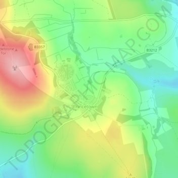
Nombre: Mapa topográfico Princetown, altitud, relieve.
Altitud media: 415 m
Altitud mínima: 347 m
Altitud máxima: 513 m
Princetown, like the rest of Dartmoor, experiences colder and wetter weather than most of Devon, especially because of its high altitude. Snow is uncommon but is usually heavy when it does fall. According to the Köppen climate classification the climate would be classified as Cfb bordering on Cfc.
Otros mapas topográficos
Haga clic en un mapa para ver su topografía, su altitud y su relieve.
Tavistock
United Kingdom > England > Devon > West Devon
Tavistock, West Devon, Devon, England, United Kingdom
Altitud media: 139 m
Chagford
United Kingdom > England > Devon > West Devon
Chagford, West Devon, Devon, England, United Kingdom
Altitud media: 309 m