
Mapa topográfico Olst
Mapa interactivo
Haga clic en el mapa para ver la altitud.
Acerca de este mapa
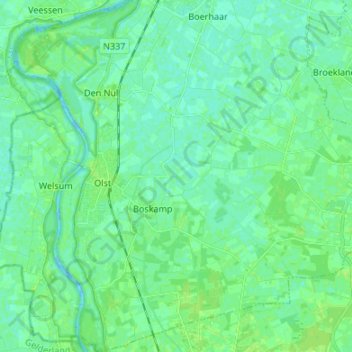
Nombre: Mapa topográfico Olst, altitud, relieve.
Lugar: Olst, Olst-Wijhe, Overijssel, Niederlande (52.29763 6.07744 52.37954 6.18927)
Altitud media: 4 m
Altitud mínima: -4 m
Altitud máxima: 10 m
Otros mapas topográficos
Haga clic en un mapa para ver su topografía, su altitud y su relieve.
Olst-Wijhe
Niederlande > Overijssel > Olst-Wijhe
Olst-Wijhe, Overijssel, Niederlande
Altitud media: 6 m
Wijhe
Niederlande > Overijssel > Olst-Wijhe
Wijhe, Olst-Wijhe, Overijssel, Niederlande
Altitud media: 3 m