
Mapa topográfico Bangkok
Mapa interactivo
Haga clic en el mapa para ver la altitud.
Bangkok
Bangkok está situada en el delta del río Chao Phraya, en la llanura central de Tailandia. El río serpentea por la ciudad en dirección sur y desemboca en el golfo de Tailandia a unos 25 km al sur del centro. La zona es llana y baja, con una altitud media de 1,5 metros sobre el nivel del mar. La mayor parte de la zona era originalmente pantanos, que se fueron drenando y regando para la agricultura con la construcción de canales (khlong) entre los siglos XVI y XIX. El curso del río a su paso por Bangkok ha sido modificado por la construcción de varios canales de atajo.
Acerca de este mapa
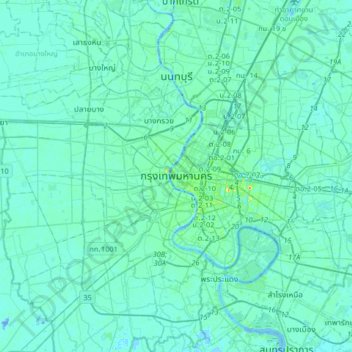
Nombre: Mapa topográfico Bangkok, altitud, relieve.
Lugar: Bangkok, 10200, Tailandia (13.59249 100.33351 13.91249 100.65351)
Altitud media: 4 m
Altitud mínima: -16 m
Altitud máxima: 42 m